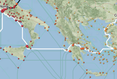
 It has become one of the largest projects in the field of digital humanities ORBIS. The developers of ORBIS from Stanford are sure that such an inquisitive and technological approach to the study of Ancient Rome will allow us to better understand how the administration and exercise of power was arranged over such a vast territory in times when there was neither the Internet nor even trains.
Video version of the basic instructions:
The program includes 632 cities and settlements, almost half of which are ports. And it covers an area of ten million square kilometers, surrounded by a network of 85,000 kilometers of roads on land and 28 - by sea.
The project is fine-tuned, so anyone who wants to can not only view the routes, but also set the season, type of transport, river currents, wind strength and direction, land landscape, and also learn about the cost of these hikes in kilograms of grain.


